Clean air for a healthier future
At the Technological University of Panama, our reasearch group specializes in air engineering studies, focusing on the critical task of monitoring air quality to safeguard public health and the environment.
Advanced monitoring systems
Our state-of-the-art equipment provides accurate and reliable air quality data essential for environmental research.
Expert analysis
Our team of experts conducts comprehensive analysis to understand the sources and impacts of air pollution, providing useful information to the community.
Air monitoring equipment

AirSence Monitoring Station
Integrated station that provides air quality metrics such as the air quality index
Location: Centenial Road, Victor Levi Sasso Campus
Air pollutants: NO, NO2, CO, O3, SO2, VOC, CO2, H2S, PM Sensor (PM10, PM 2.5, PM1)
Meteorological variables: Temperature, Humidity, Wind speed and direction and Ambient noise, Rain
Acquired thanks to the FIED22-12 project “Numerical estimation of pedestrian exposure to pollution caused by vehicular traffic” funded by SENACYT
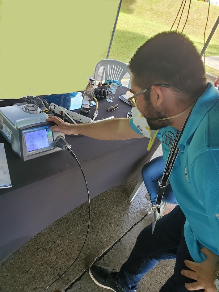
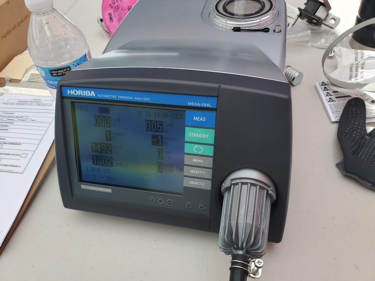
HORIBA Gas Analyzer
MEXA-584L, portable car emission analyzer for engine inspection, can measure different pollutants as well as engine revolutions and oil temperature
Atmospheric pollutants: CO, CO2, O2, HC
Acquired thanks to the FIED22-12 project “Numerical estimation of pedestrian exposure to pollution caused by vehicular traffic” funded by SENACYT

Drone Autel Evo II Pro V3
High-end drone to capture high-quality images and videos, it has a robust and foldable design, portable and easy to transport. It has a flight autonomy of 45 minutes
Atmospheric pollutants: sensors programmed with Arduino have been integrated to measure pollutants such as PM10 and 2.5 particulate matter, CO2, TVOC
Acquired thanks to the project APY-NI-2022-46 “Determination of vertical profiles of atmospheric pollutants using unmanned aerial vehicles (E-Drone)” funded by SENACYT
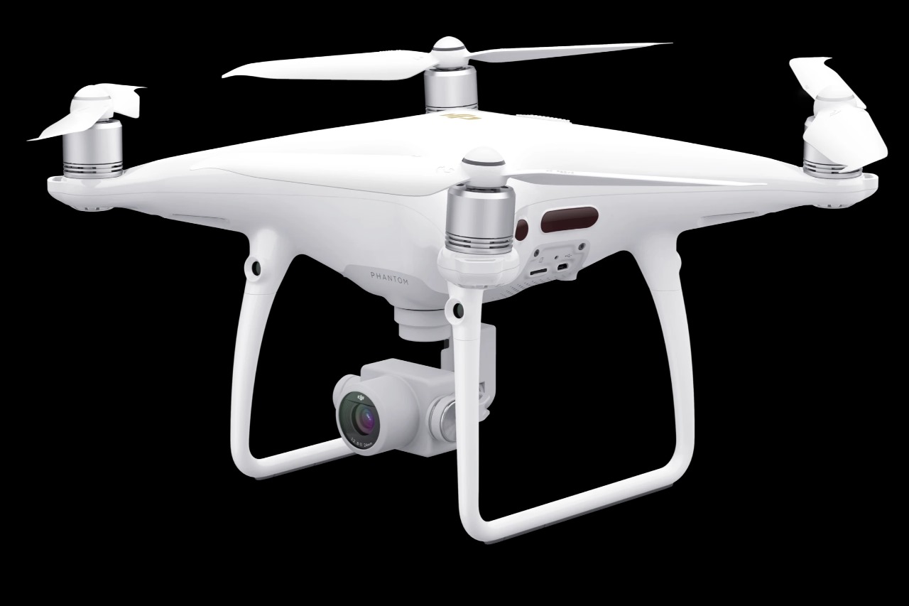
Drone DJI Phantom 4 Pro V2.0
Drone with a flight anatomy of 30 minutes, with a transmission range of up to 7 km, providing high quality images and videos, this has been used for identification tours of study areas
Acquired thanks to the IDDS22-43 project “Development and analysis of the inventory of atmospheric pollutant emissions in Panama City” funded by SENACYT
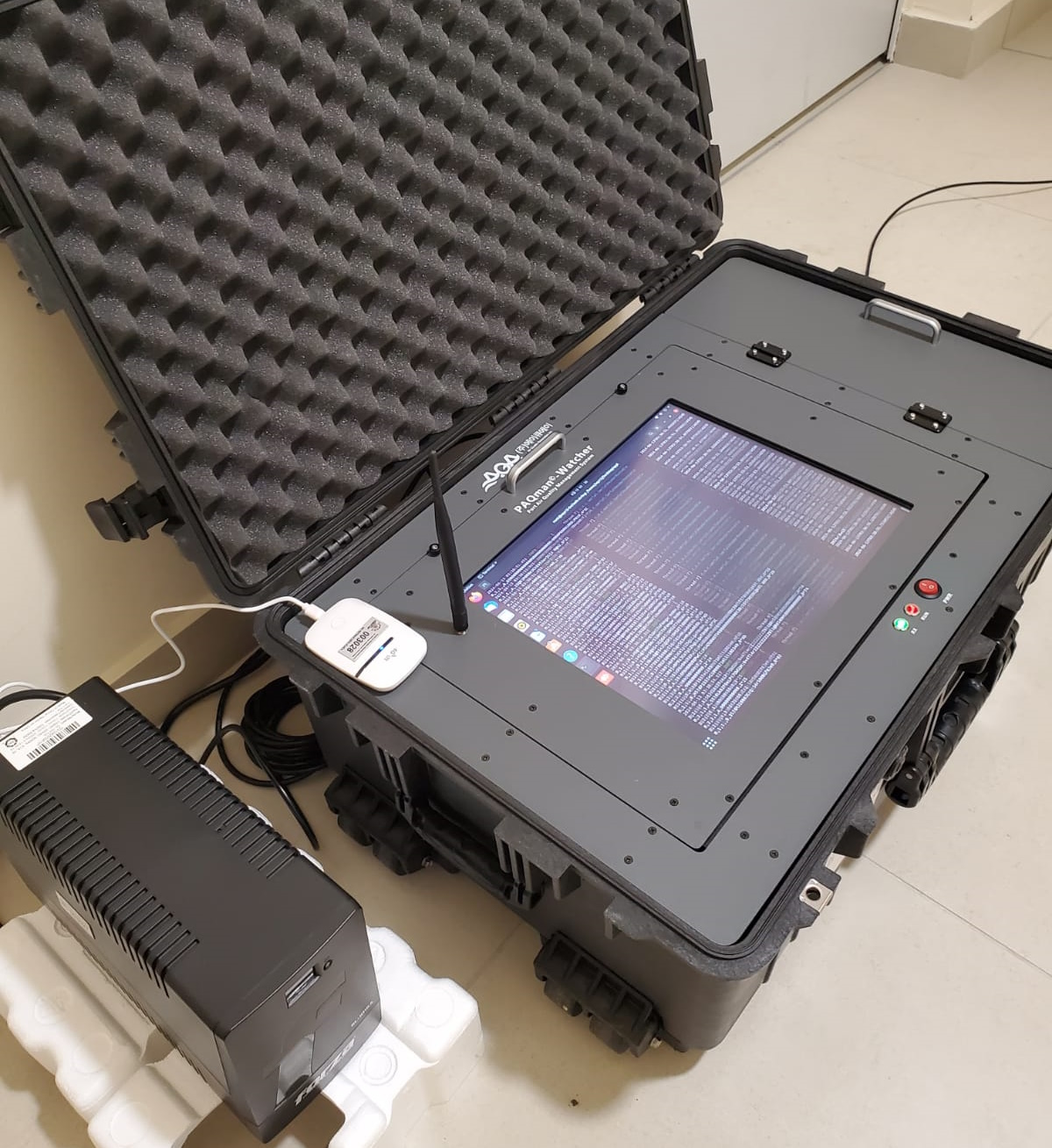
Mobile PAQman Watcher
AIS (Automatic Identification System) receiving station, which collects information on the location of ships within a certain perimeter to be subsequently sent to a central database
Location: Research and Innovation Building (ELII), Technological University of Panama
Equipment provided for the development of project MOV-2023-34 “System for estimating atmospheric emissions from ships INEMIS-SEA” funded by SENACYT
Software
Download Environmental Studies Map
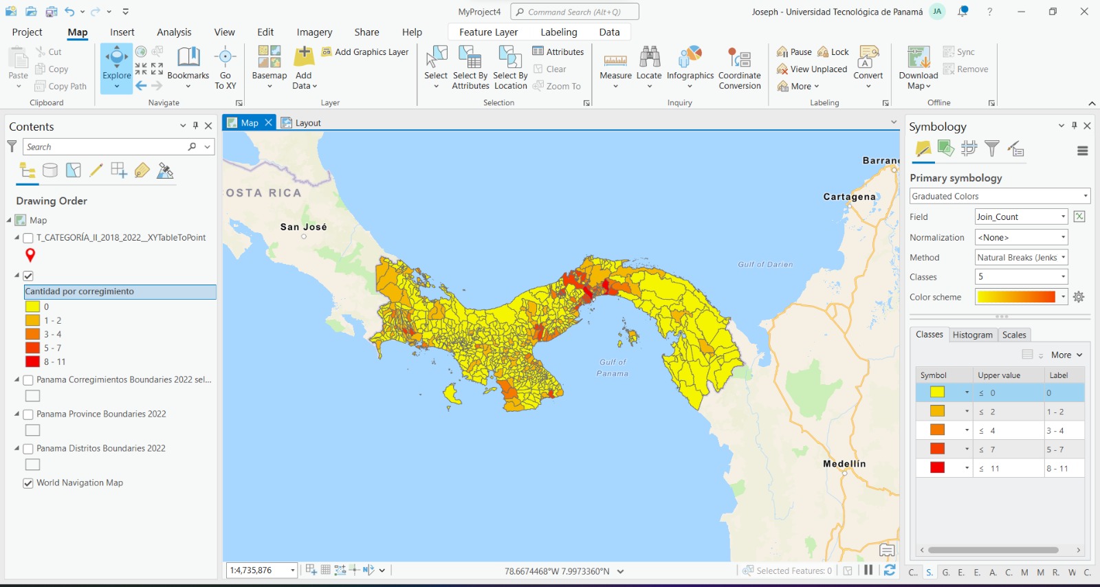
EIA CATII. Pollutant Monitoring period, 2019 – 2023
This map shows the number of category II environmental impact studies (EIA) carried out in Panama, where air pollutants were monitored between 2019 and 2023, visually highlighting the areas with the highest and lowest number of studies. The colors on the map vary from lower intensity, representing areas with fewer environmental impact studies, to higher intensity, indicating those with a greater number of studies.
This geographic representation helps to understand the distribution of environmental impact studies, assess pollution problems, and facilitate research and education on environmental impacts. In addition, it contributes to urban and rural planning, ensuring that environmental effects are considered in development, and increases public awareness of air quality and the importance of environmental protection.
